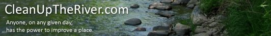
When we moved to the Saint Michael area, Paul Nordell at the Minnesota DNR introduced me to a couple of folks, via email, that he described as avid stewards of the north fork of the Crow River. One of those folks is a gentleman by the name of Curt Oien. In a short exchange of emails, Curt provided me with a bounty of information and history about the Crow. He reflected, with a well-deserved sense of pride, about the numerous clean-ups he has seen and participated in over the past six years. But he also cited a number of different organizations throughout the watershed that have made the Crow River the benefactor of their sweat and effort.
According to Curt, the Saint Michael Area River Team (SMART) has been an amazingly effective group. The team has arranged for specific sites on both sides of the river to stack garbage before it is hauled away… and they enjoy great co-operation from landowners along the Crow. They get help from the City of Saint Michael and the Three Rivers Park District... in hauling away the trash that is collected.
The river also benefits each year from help the National Honor Society and the Environmental Science Teachers at the STMA High School. The Boy Scouts and Cub scouts have been there from the beginning, in addition to many other members of the community. During the cleanup, some of the younger Cub Scouts even mark storm drains to remind people not to dump anything that doesn't belong there. (As I've written before, every storm drain and every roadside ditch is a tributary that eventually leads to a river.) The Thomas Family was involved with cleaning the river long before anyone else in the area was doing it. The past few years, their neighbors have followed their fine example.
But it doesn't stop there. Upstream, the Hanover Area River Team has been staging clean-ups for seven or eight years. And last but not least, Curt mentioned the tremendous effort of Diane Sander, the coordinator for the Crow River Watershed District (http://CrowRiver.org). (Diane was the other advocate I was told about by Paul Nordell at the DNR.)
Wow, the Crow River is obviously treasured by her neighbors. And Mr. Oien must certainly be among its’ most passionate stewards.
Curt and I have not yet met in-person, but we have arranged to take a river run this Saturday. We’ll repeat the brief voyage I took last weekend. I told him of the well liner and canoe remains that I’d like to retrieve (see the story below), and between his canoe and my kayak, he thinks we can grab them both. I’m confident we’ll either succeed, or figure out a plan that will.
© Mike Anderson, Saint Michael, MN. All rights reserved.
Wednesday, July 8, 2009
Tuesday, July 7, 2009
My first recon trip on the Crow River
On the 4th of July, I had a chance to take my first meaningful trip down the Crow River. (I had been to the Crow once before, but paddled upstream only a mile or two, and then drifted back. It was more of an upper-body workout than a kayak trip.)
Saturday was a beautiful day, weather-wise, with a light overcast sky to protect me from a very intense sun. I put in at Riverside County Park at Hanover, Minnesota, and took out near Berning’s Mill, just east of Saint Michael. “As the crow flies,” the route is only 2.6 miles, but when following the dramatic and scenic contours of the Crow, the route is closer to 5.1 river miles.
I’ll share some really nice wildlife scenes shortly (that’s what made this trip so much fun). And as “people who know the river” led me to expect, there was surprisingly little trash or debris. Only two items justified recording their location by GPS.
One of the objects seemed to be some kind of culvert or sump well liner; made of black vinyl and way too big to toss onto my kayak. The photo to the left is deceiving; it is actually about three feet in diameter, and probably more than four or five feet in length.
Saturday was a beautiful day, weather-wise, with a light overcast sky to protect me from a very intense sun. I put in at Riverside County Park at Hanover, Minnesota, and took out near Berning’s Mill, just east of Saint Michael. “As the crow flies,” the route is only 2.6 miles, but when following the dramatic and scenic contours of the Crow, the route is closer to 5.1 river miles.
I’ll share some really nice wildlife scenes shortly (that’s what made this trip so much fun). And as “people who know the river” led me to expect, there was surprisingly little trash or debris. Only two items justified recording their location by GPS.
One of the objects seemed to be some kind of culvert or sump well liner; made of black vinyl and way too big to toss onto my kayak. The photo to the left is deceiving; it is actually about three feet in diameter, and probably more than four or five feet in length.The other item, I think, is what's left of a sectioned plastic canoe that probably failed to survive one of the several light rapids
near here. If it is a canoe (and I’m only guessing that’s what it is), it is only the center section; the gunnels are missing, as well as the fore and aft sections of the craft. But knowing I would have to return for the well liner, I decided to save this item for my return trip, too. If weather permits next weekend, I’ll bring along my portable reciprocating saw, and take both objects out in sections. (As always, click on any photo to enlarge.)
near here. If it is a canoe (and I’m only guessing that’s what it is), it is only the center section; the gunnels are missing, as well as the fore and aft sections of the craft. But knowing I would have to return for the well liner, I decided to save this item for my return trip, too. If weather permits next weekend, I’ll bring along my portable reciprocating saw, and take both objects out in sections. (As always, click on any photo to enlarge.)© Mike Anderson, Saint Michael, MN. All rights reserved.
Thursday, June 18, 2009
If you are visiting for the first time...
Welcome. Between coverage we’ve received recently from Minnesota Waters, Minnesota Trails or Field and Stream magazine, it occurs to me that a good number of folks might be visiting this site for the first time. So let me catch you up.
CleanUpTheRiver.com is neither a non-profit organization, nor a for-profit enterprise. It is simply a blog, which we use to share what we’ve learned and experienced... as my wife and I develop some new ideas for river restoration and conservation. We like to share our photos (click on any image to enlarge it). And we like to share our simple premise: Anyone, on any given day, has the power to improve a place.
Geo-trashing is one example of an idea we've developed. When we adopted our third river segment--this one on the Mississippi--we found a much different pollution problem that the light trash we were used to on our two stretches of the scenic St. Croix River. There were tires, barrels, construction debris, appliances… things that you cannot lift and carry away on a kayak. So we started collecting digital photos and GPS waypoints of where these items had been discarded, with the idea that we could return with the appropriate tools to collect the trash later. So, it's something like geo-caching, except the treasure we're hunting for is trash. (A recent KARE 11 TV news story explained geo-trashing well. Click here to watch it.)
But that’s just one example of what we’re learning. We’ve also learned how to create GPS maps of trash targets, sorted by debris type, and how to convert them into “ARC-compliant” maps (the kind used by many government agencies). Now, some of our trash maps are actually being used to guide one park district’s conservation effort in a series of riverside re-development projects. We’ve learned how jurisdictions work—and sometimes how they do not—between cities, counties, state and federal agencies. And we’ve learned how dumping and pollution are often crimes of convenience and opportunity. (With nowhere else to put them without getting caught, crooks love to toss emptied safes in the river. We’ve found ten safes, so far). And we’ve learned a little bit about how to clean this junk up.
The web has been an economical tool, and we’re trying to use it as it was intended to be used: To share ideas. If you’d like to get in touch, just drop me an email. If you have knowledge about or experience in matters of conservation… please share it! And if you have a question, please feel free to ask it. Perhaps you’ll take an idea from this site that helps you make an impact in your community... or maybe you'll share an idea that makes us more productive.
CleanUpTheRiver.com is neither a non-profit organization, nor a for-profit enterprise. It is simply a blog, which we use to share what we’ve learned and experienced... as my wife and I develop some new ideas for river restoration and conservation. We like to share our photos (click on any image to enlarge it). And we like to share our simple premise: Anyone, on any given day, has the power to improve a place.
Geo-trashing is one example of an idea we've developed. When we adopted our third river segment--this one on the Mississippi--we found a much different pollution problem that the light trash we were used to on our two stretches of the scenic St. Croix River. There were tires, barrels, construction debris, appliances… things that you cannot lift and carry away on a kayak. So we started collecting digital photos and GPS waypoints of where these items had been discarded, with the idea that we could return with the appropriate tools to collect the trash later. So, it's something like geo-caching, except the treasure we're hunting for is trash. (A recent KARE 11 TV news story explained geo-trashing well. Click here to watch it.)
But that’s just one example of what we’re learning. We’ve also learned how to create GPS maps of trash targets, sorted by debris type, and how to convert them into “ARC-compliant” maps (the kind used by many government agencies). Now, some of our trash maps are actually being used to guide one park district’s conservation effort in a series of riverside re-development projects. We’ve learned how jurisdictions work—and sometimes how they do not—between cities, counties, state and federal agencies. And we’ve learned how dumping and pollution are often crimes of convenience and opportunity. (With nowhere else to put them without getting caught, crooks love to toss emptied safes in the river. We’ve found ten safes, so far). And we’ve learned a little bit about how to clean this junk up. There is no revenue model for our project, and we do not solicit donations. We absorb our modest expenses out-of-pocket… and have to save-up for new equipment the same way anyone else would.
The web has been an economical tool, and we’re trying to use it as it was intended to be used: To share ideas. If you’d like to get in touch, just drop me an email. If you have knowledge about or experience in matters of conservation… please share it! And if you have a question, please feel free to ask it. Perhaps you’ll take an idea from this site that helps you make an impact in your community... or maybe you'll share an idea that makes us more productive. So again, thanks for stopping in. And enjoy.
Mike
Mike
© 2009 Mike D. Anderson, St. Michael, MN. All rights reserved.
Tuesday, June 16, 2009
Well, since you put it that way...
An old friend called today, to comment on the several articles that have been published about our project recently. "Perhaps the trash you've taken from the river is less significant... than the awareness you have brought to it."
His remark made me stop & think. Good friends do that; it is one of the reasons they're good friends.
© 2009 Mike D. Anderson, St. Michael, MN. All rights reserved.
His remark made me stop & think. Good friends do that; it is one of the reasons they're good friends.
© 2009 Mike D. Anderson, St. Michael, MN. All rights reserved.
Here's an example of "before and after"
Having recently moved into a new neighborhood, I’ve met a couple of new friends in the St. Michael area that wanted an example of what a Geo-Trashing map looks like. So I'll share a pair.
Our most successful project last year came from part of the north metro Mississippi River, on the west bank, which is largely under the jurisdiction of the Three Rivers Park District. They had only acquired the property recently, so there was still a lot of junk sitting in or near the river, waiting to be removed. I took several kayak trips down that stretch of river, and created an inventory map that looked something like this. (Click on the map below to enlarge.)
View Pre Clean-up Mississippi Targets 7-20-08 in a larger map
Note that this is a simple Google Map. We can provide versions in a variety of languages, including MapPoint (compatible with Garmin GPS devices), Google Earth, and even ARC-compliant language (the preference of most government agencies, architects and engineers).
Each of the flags (or “waypoints) on this map represents a large trash item or debris field… and each of these sites has a corresponding photo. So the trash hunter knows what they’re looking for, as well as where they’ll find it.
But here’s the good news. After re-visiting this area of the Three Rivers Park District last fall, here’s what the map look like now:
View Post Clean-up Mississippi 9-20-08 in a larger map
Most of what was on that map was moved into a utility trailer, and disposed of properly. (The trailer load you see here weighed roughly 885 pounds, and all but one piece of trash—a wooden door frame—was to a scrap iron dealer and has since been recycled.) The one flag that remains on this map represents a water heater or LP tank I could not lift out of the muck on my own. (But here's a video of the stuff I could lift!)
You know, most of our clean-up work involves paddling along in a kayak, grabbing plastic beverage bottles, beer cans, bait containers or other light trash. But it’s the use of technology to inventory and then recover the big stuff that seems to get all the attention. So let me just offer this one simple reminder: Anyone with a trash bag and an old pair of tennis shoes can conduct a clean-up in a park, on a trail, or on a riverbank. Anyone, on any given day, has the power to improve a place.
© 2009 Mike D. Anderson, St. Michael, MN. All rights reserved.
Our most successful project last year came from part of the north metro Mississippi River, on the west bank, which is largely under the jurisdiction of the Three Rivers Park District. They had only acquired the property recently, so there was still a lot of junk sitting in or near the river, waiting to be removed. I took several kayak trips down that stretch of river, and created an inventory map that looked something like this. (Click on the map below to enlarge.)
View Pre Clean-up Mississippi Targets 7-20-08 in a larger map
Note that this is a simple Google Map. We can provide versions in a variety of languages, including MapPoint (compatible with Garmin GPS devices), Google Earth, and even ARC-compliant language (the preference of most government agencies, architects and engineers).
Each of the flags (or “waypoints) on this map represents a large trash item or debris field… and each of these sites has a corresponding photo. So the trash hunter knows what they’re looking for, as well as where they’ll find it.But here’s the good news. After re-visiting this area of the Three Rivers Park District last fall, here’s what the map look like now:
View Post Clean-up Mississippi 9-20-08 in a larger map
Most of what was on that map was moved into a utility trailer, and disposed of properly. (The trailer load you see here weighed roughly 885 pounds, and all but one piece of trash—a wooden door frame—was to a scrap iron dealer and has since been recycled.) The one flag that remains on this map represents a water heater or LP tank I could not lift out of the muck on my own. (But here's a video of the stuff I could lift!)You know, most of our clean-up work involves paddling along in a kayak, grabbing plastic beverage bottles, beer cans, bait containers or other light trash. But it’s the use of technology to inventory and then recover the big stuff that seems to get all the attention. So let me just offer this one simple reminder: Anyone with a trash bag and an old pair of tennis shoes can conduct a clean-up in a park, on a trail, or on a riverbank. Anyone, on any given day, has the power to improve a place.
© 2009 Mike D. Anderson, St. Michael, MN. All rights reserved.
Monday, June 15, 2009
Ahhh... so this chapter has a happy ending after all
This winter and spring, I spent quite a little time researching some potential equipment upgrades. There are a couple of Nikon and Sony digital cameras out there which are capable of recording GPS waypoint information directly to the digital photo file at the instant a photo is taken. A Digital SLR camera would be ideal for this use, but they are very, very expensive. On the other hand, National Camera sells a Nikon compact that is GPS-enabled for right around $500. Another option is something called a Jobo GPS Tagger, which I think might connect to my current camera, and log the corresponding latitude and longitude as each shot is taken. I have more homework to do on that one, though.
I was excited about this idea. Right now, the process of Geo-Trashing can be rather cumbersome and time-consuming. When you find the debris field or dumped item, you must first snap a digital photo, then hunt-and-peck on the handheld GPS to create and label a waypoint, one letter at a time. Then, back at the office, you have to make sure you’re mating the right GPS waypoints to the corresponding photo. With a GPS-enabled camera, all of this would become a much faster one- or two-step process. If it works they way I’m thinking, I could cover many more river miles, and record more trash targets, all in less time.
But then, the break-in at our home happened. That basically nixed the new camera idea, forcing us to think about replacing original equipment and paying deductibles… instead of making the upgrades I had hoped for. As I’ve stated before, we are neither a non-profit organization nor a for-profit business; aside from the kayaks on loan to us from Joe's Sporting Goods, everything we do with this project is out-of-pocket.
But here’s the happy ending to this chapter of our story. The Heroes of Conservation recognition we’ll receive from Field and Stream next month comes with a $1,000 grant, courtesy of the program’s sponsor, Toyota. While perhaps not one of the fancier D-SLR models (they run two-thousand dollars or so), that puts a GPS-enabled camera back within our reach. (We can get started with the cheaper, compact version... and if it works well, I’ll save up for the more sophisticated D-SLR camera.) I think testing this equipment in the field is a wise use of the Heroes of Conservation grant money.
This summer, my goal is to hit some new, unfamiliar waterways, beyond our adopted segments of the St. Croix and Mississippi rivers. A quicker way of recording and merging GPS waypoints and digital photos would make those trips much more productive.
© 2009 Mike D. Anderson, St. Michael, MN. All rights reserved.
A friend maps our way to Field and Stream
Back in April, I received a phone call from a gentleman by the name of Tom McCafferty, a conservation writer for Field and Stream magazine. He informed me that I had been nominated for what the magazine calls their “Heroes of Conservation” program; the nomination had come from our good friend Joe Rauscher at Joe's Sporting Goods. Joe was at a trade show earlier this year, and came across the Field and Stream booth promoting the Heroes of Conservation program.
Early in the call, Tom started a line of questioning that turned into a full a half-hour telephone interview. He asked for sample maps, photographs and other materials… so I gave him a quick tour of our blog and suggested a few online videos he might benefit from seeing. Tom called again in early May, to let me know that upon further review by the editorial staff, I had indeed been selected, and would be included in their Heroes of Conservation section in the July 2009 issue of Field and Stream.
Click here to see a scanned advance copy of the Hero’s of Conservation write-up that I received by email today.
© 2009 Mike D. Anderson, St. Michael, MN. All rights reserved.
Early in the call, Tom started a line of questioning that turned into a full a half-hour telephone interview. He asked for sample maps, photographs and other materials… so I gave him a quick tour of our blog and suggested a few online videos he might benefit from seeing. Tom called again in early May, to let me know that upon further review by the editorial staff, I had indeed been selected, and would be included in their Heroes of Conservation section in the July 2009 issue of Field and Stream.This recognition has important ramifications for our humble little project… but more on that later. For now, I would simply like to thank Joe Rauscher for the time and thought required to submit our project nomination. CleanUpTheRiver.com certainly has a friend in Joe’s Sporting Goods. Not a financial sponsorship, but a relationship that is even more valued and important: Informed advice, and authentic friendship. Everytime we hit the river, we feel like Joe's team is with us. Thanks, Joe. And thanks to Tom McCafferty and the editors of Field and Stream, as well as your national sponsor for this program, Toyota. I think this is a great thing you're doing... and I appreciate it.
Click here to see a scanned advance copy of the Hero’s of Conservation write-up that I received by email today.
© 2009 Mike D. Anderson, St. Michael, MN. All rights reserved.
Sunday, June 14, 2009
Pesky, but perfect
It is easy to become annoyed by the cottonwood seeds this time of year. They fly into your eyes and face, and they stick to everything that is wet… whether that’s a sweaty face and neck, or a yak that’s being pulled from the water. The fluffy specs turn into a
scum that gets particularly thick in eddies where the current slows. Look closer at those side ponds, and you’ll see the helicopter seeds of ash, maple and box elder, as well as floating chestnuts, pine cones, and the seed pods of American elm.
One cannot curse the cottonwood seeds, and then celebrate the thick tree stands that border the river. They are mutually dependent.
scum that gets particularly thick in eddies where the current slows. Look closer at those side ponds, and you’ll see the helicopter seeds of ash, maple and box elder, as well as floating chestnuts, pine cones, and the seed pods of American elm.As annoying as the cottonwood seeds can be, they are taking the current for an important ride. After the breeze drops them into the river, the river carries them to a place where they can wash ashore and take root.
© 2009 Mike D. Anderson, St. Michael, MN. All rights reserved.
Rivers and rewards
As I had hoped, I got out on the kayak today. But instead of heading out to Pelican Lake, as I had originally planned, I made way for the Crow River just east of Saint Michael. I didn’t go far. I put in at the landing where Nabor Road crosses the river. Without an up-to-date GPS, I went the safe way… paddling upstream about two miles, and then letting myself drift back. (A bad experience on the St. Croix River taught me to not drift down on the first leg and then paddle back upstream on the second leg. Always good to know you’re spending fuel on the way out, and then gliding on the way back!)
As if I needed it, I got a second reward a few yards further down the river. I had seen an egret on the way up the river down the second bend. So, I lifted my paddle to drift with the current on the way back down, thinking I could get much closer to the big bird on my way back, using the element of surprise. My plan worked. I was able to study the huge crane as he fished from his perch on a log. (As always, click on any photo to enlarge it. Then, hit your "Back" button to return to this spot.)
Finally, as I got a little too close, he took flight… screeching at me for invading his territory. I was amazed by the loudness of his call… and delighted to snap a second shot of the huge bird as he became airborne. It was cool enough that I turned around and paddled back upstream to get a second look, where he had come to rest on a sand bar upstream. It was worth the effort… this breed of fowl is an amazing bird to study.
You can see these creatures in a zoo. But so much better, it is, to see them in freedom of their element.
It was a lot of work heading against the current today. I was a bit surprised by the strength of the Crow’s current. But I was rewarded significantly. Today, I saw my first otter. I’ve been wanting to see one for a long time… but I’ve been zipped until today. They are curious creatures; the little critter was as enamored with me as I with he. He’d peak from the shoreline, then scurry into the grass and run downstream to take another look, as if to see whether I could keep up with him. I was able to keep pace, but I didn't successfully get a shot of him with my camera. (Some animals simply do not stop to pose for human popperatzi.)
© 2009 Mike D. Anderson, St. Michael, MN. All rights reserved.
Thursday, June 11, 2009
Getting aquainted with some new waterways
Returning home from a travel assignment this week, I was pleased to see that FedEx had delivered the two GPS devices we had ordered to replace those stolen during the break-in back in April. The timing is perfect! Tonight, I will program the new GPS units with updated maps. With rain in the forecast for tomorrow, I’ll use the day to build a kayak storage system in my garage (we cannot store them outside in the neighborhood we live in, so I’m designing a system that will help me hang them from the ceiling of the garage with pulleys). But Sunday, I’m eager to explore one of the two new bodies of water that we now live near. One of those streams is the Crow River, which I’m told is a perfect paddling river.
But there is another spot I’d like to explore. Having driven a few times around the west side of Saint Michael, I thought I had come across a series of broad sloughs and wetlands. But looking more closely at a map of the area, I have learned that they are really the coves and inlets of a larger body, known as Pelican Lake. There are two reasons that kayaking the lake is appealing to me. First, it is not attractive to big boats and jet skis (a new neighbor tells me that it’s about ten feet at its deepest point). But second, it is somewhat secluded, and in many places not far from various roadways; I will almost certainly discover that it is the victim of dumping. We’re not talking about litter, here, but things like appliances, tires, etc. Dumping large objects is largely a crime of opportunity and convenience; when proximity to a bridge or roadway makes dumping easy, and unlikely that the dumping will be seen by passers-by, that’s where you’ll find junk in the water.)
In any regard, it will be fun to navigate a new waterway… and I’m looking forward to getting acquainted.
© 2009 Mike D. Anderson, St. Michael, MN. All rights reserved.
Subscribe to:
Posts (Atom)